
1957 Map of Devils Tooth
USGS Topo · Published 1959About this map
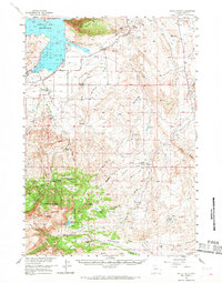
Buffalo Bill Reservoir dominates the northwestern corner of this Wyoming landscape, where the South Fork Shoshone River feeds into the controlled waters just west of Cedar Mountain. The 1957 field survey reveals a region defined by the intersection of high-altitude ranching and the emerging energy industry of the late 1950s. Established ranching operations like the Diamond Bar Ranch and Hoodoo Ranch occupy the drainages of Carter Creek and Sage Creek, while the presence of the Half Moon Oil Field, the Spring Creek Oil Field, and a Sulphur Refinery indicate the intense industrial activity characterizing the Basin. To the southwest, the terrain rises sharply into the Shoshone National Forest, reaching landmarks like the jagged Devils Tooth and the high elevations of Carter Mountain, providing a stark contrast to the irrigation networks of the Cody Canal and Indian Lateral on the basin floor.
Find a feature on this map
56 named features on this map. Tap any name to fly to it.
Don’t see what you’re looking for? This feature index may not catch every label — zoom into the map to look around manually.
Map Details
Editions of this 1957 Devils Tooth Map
4 editions found
Other maps of this area

1911 · Meeteetse
USGS Topo · 1:62,500

1911 · Oregon Basin
USGS Topo · 1:62,500

1913 · Oregon Basin
USGS Topo · 1:62,500

1913 · Meeteetse
USGS Topo · 1:62,500

1949 · Pat O'Hara Mountain
USGS Topo · 1:62,500

1949 · Cody
USGS Topo · 1:62,500

1951 · Cody
USGS Topo · 1:62,500

1955 · Cody
USGS Topo · 1:250,000

1957 · Wapiti
USGS Topo · 1:62,500

1957 · Irish Rock
USGS Topo · 1:62,500