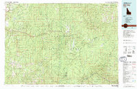
1981 Map of Elk City
USGS Topo · Published 1981About this map
Elk City and the historic gold-bearing districts of Idaho County are documented here during a period of modern geologic survey in the early 1980s. The landscape is defined by the complex drainages of the South Fork Clearwater River and the Salmon River, which carved deep corridors through the Nez Perce and Bitterroot National Forests. This map is particularly significant for its dense concentration of mining claims, reflecting a century of mineral extraction. Large-scale operations and smaller prospects like the Mother Lode Mine, Golden Hand Mine, and Orogrande-Frisco Mine appear alongside established mountain outposts like Orogrande and Golden. The inclusion of high-elevation points such as Buffalo Hump and Gospel Peak illustrates the challenging geography that early miners and foresters navigated to reach remote lodes and timber stands.
Find a feature on this map
125 named features on this map. Tap any name to fly to it.
Don’t see what you’re looking for? This feature index may not catch every label — zoom into the map to look around manually.
Map Details
Editions of this 1981 Elk City Map
2 editions found
Other maps of this area

1911 · Lolo
USGS Topo · 1:250,000

1913 · Lolo
USGS Topo · 1:250,000

1924 · Kamiah
USGS Topo · 1:125,000

1924 · Weippe
USGS Topo · 1:125,000

1931 · Buffalo Hump
USGS Topo · 1:125,000

1934 · Buffalo Hump
USGS Topo · 1:125,000

1938 · Riggins
USGS Topo · 1:96,000

1945 · Riggins
USGS Topo · 1:125,000

1955 · Pullman
USGS Topo · 1:250,000

1955 · Grangeville
USGS Topo · 1:250,000