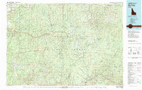
1981 Map of Elk City
USGS Topo · Published 1981About this map
Elk City serves as the central hub of this 1981 survey, positioned at the confluence of the American River and Red River. The map documents a landscape defined by significant mining activity and wilderness preservation within the Nez Perce National Forest. To the southwest, the mining legacy of the region is evident through clusters of operations such as the Buffalo Hump Mine, Mother Lode Mine, and Blue Ribbon Mine, centering around the peaks of Buffalo Hump and Old Orogrande.
Find a feature on this map
62 named features on this map. Tap any name to fly to it.
Don’t see what you’re looking for? This feature index may not catch every label — zoom into the map to look around manually.
Map Details
Editions of this 1981 Elk City Map
2 editions found
Other maps of this area

1911 · Lolo
USGS Topo · 1:250,000

1913 · Lolo
USGS Topo · 1:250,000

1924 · Kamiah
USGS Topo · 1:125,000

1924 · Weippe
USGS Topo · 1:125,000

1931 · Buffalo Hump
USGS Topo · 1:125,000

1934 · Buffalo Hump
USGS Topo · 1:125,000

1938 · Riggins
USGS Topo · 1:96,000

1945 · Riggins
USGS Topo · 1:125,000

1955 · Pullman
USGS Topo · 1:250,000

1955 · Grangeville
USGS Topo · 1:250,000