
2015 Map of Elk Creek
USGS Topo · Published 2015About this map
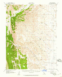
Elk Creek lies at the transition between the valley floor and the rising eastern edge of the Mendocino National Forest. This region is defined by the engineered waters of the Stony Gorge Reservoir, which captures the flow of Stony Creek as it moves through the foothills of Glenn County. The landscape is a network of named ridges and canyons, including Bowman Ridge and Bowman Canyon, reflecting a topography deeply tied to the ranching and agricultural life of Northern California. Modern infrastructure such as the Diamond M Ranch Airport sits alongside historic county routes like Co Road 306, which follows the reservoir’s western shore. The geography is punctuated by distinctive geological features like Briscoe Rocks and sheltered pockets such as Green Valley, illustrating how the drainage of Briscoe Creek and its forks have shaped the local terrain over generations.
Find a feature on this map
30 named features on this map. Tap any name to fly to it.
Don’t see what you’re looking for? This feature index may not catch every label — zoom into the map to look around manually.
Map Details
Editions of this 2015 Elk Creek Map
This is the sole edition of this map. No revisions or reprints were ever made.
Other maps of this area

1919 · Fruto
USGS Topo · 1:62,500

1919 · Elk Creek
USGS Topo · 1:62,500

1943 · Lodoga
USGS Topo · 1:62,500

1944 · Fruto
USGS Topo · 1:62,500

1948 · Elk Creek
USGS Topo · 1:62,500

1951 · Stonyford
USGS Topo · 1:62,500

1957 · Elk Creek
USGS Topo · 1:62,500

1957 · Ukiah
USGS Topo · 1:250,000
1958 · Fruto
USGS Topo · 1:62,500

1960 · Ukiah
USGS Topo · 1:250,000