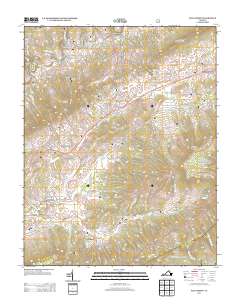
2013 Map of Elk Garden
USGS Topo · Published 2013About this map
The Clinch River winds through this section of Russell County, defining a landscape shaped by deep valleys and prominent ridges. Several small communities and historic junctions anchor the area, including Blackford, Hubbard Junction, and Smithfield. The map reveals a high density of named hollows and gaps that suggest a long history of local land use and family-named landmarks, such as Patrick Hollow, Hess Hollow, and John Hess Hollow.
Find a feature on this map
83 named features on this map. Tap any name to fly to it.
Don’t see what you’re looking for? This feature index may not catch every label — zoom into the map to look around manually.
Map Details
Editions of this 2013 Elk Garden Map
This is the sole edition of this map. No revisions or reprints were ever made.
Other maps of this area

1886 · Grundy
USGS Topo · 1:125,000

1890 · Grundy
USGS Topo · 1:125,000

1891 · Tazewell
USGS Topo · 1:125,000

1891 · Abingdon
USGS Topo · 1:125,000

1892 · Grundy
USGS Topo · 1:125,000

1894 · Abingdon
USGS Topo · 1:125,000

1895 · Tazewell
USGS Topo · 1:125,000

1897 · Tazewell
USGS Topo · 1:125,000

1897 · Bristol
USGS Topo · 1:125,000

1902 · Bristol
USGS Topo · 1:125,000