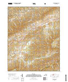
2019 Map of Elk Garden
USGS Topo · Published 2019About this map
Clinch River headwaters and the rising slopes of Clinch Mountain define this corner of Russell County, where deep hollows and high ridges dictate the path of local settlements. The area is marked by a legacy of family homesteads, evidenced by the high concentration of private burial grounds such as John W Ball Cem, Stump Cem, and Honaker-Ray Cem. These sites follow the drainage of Lewis Cr and Hubbard Br, illustrating the historical pattern of mountain valley farming.
Find a feature on this map
123 named features on this map. Tap any name to fly to it.
Don’t see what you’re looking for? This feature index may not catch every label — zoom into the map to look around manually.
Map Details
Editions of this 2019 Elk Garden Map
This is the sole edition of this map. No revisions or reprints were ever made.
Other maps of this area

1886 · Grundy
USGS Topo · 1:125,000

1890 · Grundy
USGS Topo · 1:125,000

1891 · Tazewell
USGS Topo · 1:125,000

1891 · Abingdon
USGS Topo · 1:125,000

1892 · Grundy
USGS Topo · 1:125,000

1894 · Abingdon
USGS Topo · 1:125,000

1895 · Tazewell
USGS Topo · 1:125,000

1897 · Tazewell
USGS Topo · 1:125,000

1897 · Bristol
USGS Topo · 1:125,000

1902 · Bristol
USGS Topo · 1:125,000