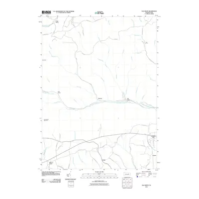
2010 Map of Elk Grove
USGS Topo · Published 2010About this map
West Branch Fishing Creek and its many tributaries, including Bloody Run and Shingle Mill Run, define the drainage patterns of this central Pennsylvania landscape. Small settlements and camps are scattered throughout the valleys, with Elk Grove and Emmons situated along the main branch of the creek. To the south, the terrain levels slightly as Little Fishing Creek flows near the communities of Richarts Grove and Divide.
Find a feature on this map
65 named features on this map. Tap any name to fly to it.
Don’t see what you’re looking for? This feature index may not catch every label — zoom into the map to look around manually.
Map Details
Editions of this 2010 Elk Grove Map
This is the sole edition of this map. No revisions or reprints were ever made.
Other maps of this area

1894 · Bloomsburg
USGS Topo · 1:62,500

1927 · Eagles Mere
USGS Topo · 1:48,000

1932 · Eagle Mere
USGS Topo · 1:62,500

1934 · Laporte
USGS Topo · 1:62,500

1935 · Hughesville
USGS Topo · 1:62,500

1947 · Stillwater
USGS Topo · 1:24,000

1947 · Benton
USGS Topo · 1:31,680
1953 · Benton
USGS Topo · 1:24,000

1953 · Hughesville
USGS Topo · 1:62,500

1953 · LaPorte
USGS Topo · 1:62,500
Featured Places
- Jackson Township, PA
- Laporte Township, PA
- Pine Township, PA
- Divide, Jackson Township
- Emmons, Davidson Township