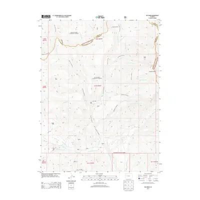
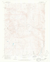
2013 Map of Elk Knob
USGS Topo · Published 2013About this map
Huntsman Ridge and the prominent Elk Knob anchor this high-elevation landscape along the border of Mesa and Gunnison counties. The area is defined by the intersection of the White River National Forest and the Gunnison National Forest, where a network of administrative trails like the Clear Fork Trail 8810.0 and Gooseberry Trail 8814.0 navigate the headwaters of numerous drainages. Water management is evident in features such as the Clear Fork Ditch, which redirects flow near Basin Creek. Low-lying recreational or historic transit points include Battle Park and Jones Park, while the southern reaches are dissected by the complex branching of Bainard Creek, North Bainard Creek, and South Bainard Creek. This terrain reflects a modern era of forest management where traditional topographic landmarks like Stove Basin coexist with specific forest service trail designations.
Find a feature on this map
49 named features on this map. Tap any name to fly to it.
Don’t see what you’re looking for? This feature index may not catch every label — zoom into the map to look around manually.
Map Details
Editions of this 2013 Elk Knob Map
This is the sole edition of this map. No revisions or reprints were ever made.
Other maps of this area

1957 · Leadville
USGS Topo · 1:250,000

1959 · Leadville
USGS Topo · 1:250,000
1960 · Leadville
USGS Topo · 1:250,000
1961 · Electric Mountain
USGS Topo · 1:24,000
1961 · Spruce Mountain
USGS Topo · 1:24,000
1962 · Leadville
USGS Topo · 1:250,000
1963 · Chair Mountain
USGS Topo · 1:24,000
1963 · Flatiron Mountain
USGS Topo · 1:24,000
1963 · Bull Mountain
USGS Topo · 1:24,000
1963 · Placita
USGS Topo · 1:24,000