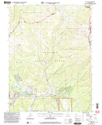
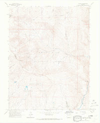
2001 Map of Elk Knob
USGS Topo · Published 2004About this map
Gunnison National Forest and White River National Forest dominate this high-altitude landscape at the beginning of the twenty-first century. The terrain is defined by complex drainage systems flowing from Huntsman Ridge and the prominent volcanic profile of Elk Knob. In the lower elevations near the southern border, small clearings such as Tolan Place and Olson Place indicate localized land use within a region otherwise managed for timber and watershed protection. The convergence of numerous watercourses including the Clear Fork, Muddy Creek, and Coal Creek highlights the importance of the area's hydrology, underscored by the presence of a Gaging Sta and multiple wells. Historic routes like the Ranger Ridge Trail wind through the gulches, connecting landmarks like Jones Park to the higher basins used for seasonal grazing or resource management.
Find a feature on this map
62 named features on this map. Tap any name to fly to it.
Don’t see what you’re looking for? This feature index may not catch every label — zoom into the map to look around manually.
Map Details
Editions of this 2001 Elk Knob Map
This is the sole edition of this map. No revisions or reprints were ever made.
Other maps of this area

1957 · Leadville
USGS Topo · 1:250,000

1959 · Leadville
USGS Topo · 1:250,000

1960 · Leadville
USGS Topo · 1:250,000

1961 · Electric Mountain
USGS Topo · 1:24,000

1961 · Spruce Mountain
USGS Topo · 1:24,000

1962 · Leadville
USGS Topo · 1:250,000
1963 · Chair Mountain
USGS Topo · 1:24,000
1963 · Flatiron Mountain
USGS Topo · 1:24,000
1963 · Bull Mountain
USGS Topo · 1:24,000
1963 · Placita
USGS Topo · 1:24,000