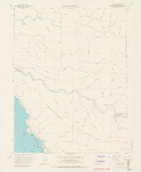
1960 Map of Elk
USGS Topo · Published 1967About this map
The coastal hamlet of Elk anchors this coastal survey, where the rugged Mendocino shoreline meets the timber-heavy ridges of the California Coast Ranges. Settlement patterns here are dictated by the steep topography, with legacy labels like Cuffeys Cove and the Greenwood Sch marking the community's mid-century footprint. Further inland, the landscape is defined by a series of parallel elevations including Albion Ridge, Navarro Ridge, and Greenwood Ridge, which separate the drainages of the Albion River and the Navarro River. Evidence of historical industry and land management is visible through features such as the Bear Pen Flume, an Airstrip, and the Dimmick Memorial Grove State Park. Small inland settlements like Goodyear and Watson appear alongside complex gulch systems, reflecting the era's focus on water resources and forestry access.
Find a feature on this map
60 named features on this map. Tap any name to fly to it.
Don’t see what you’re looking for? This feature index may not catch every label — zoom into the map to look around manually.
Map Details
Editions of this 1960 Elk Map
3 editions found
Other maps of this area

1920 · Glenblair
USGS Topo · 1:62,500

1920 · Fort Bragg
USGS Topo · 1:62,500

1943 · Glenblair
USGS Topo · 1:62,500

1943 · Fort Bragg
USGS Topo · 1:62,500

1943 · Albion
USGS Topo · 1:62,500

1943 · Navarro
USGS Topo · 1:62,500

1944 · Saddle Point
USGS Topo · 1:62,500

1957 · Ukiah
USGS Topo · 1:250,000

1960 · Ukiah
USGS Topo · 1:250,000
1960 · Elk
USGS Topo · 1:24,000