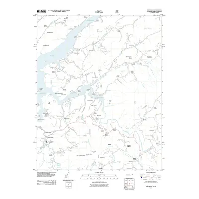
2011 Map of Elk Mills
USGS Topo · Published 2011About this map
Watauga Lake dominates the northern landscape of this terrain, where the Watauga River and Elk River converge near the Tennessee and North Carolina border. The area is characterized by a dense network of mountain communities and family-named landmarks, including Buntontown, Peoria, and Elk Mills. Local history is deeply etched into the topography through numerous burial grounds such as Grindstaff Cemetery, Proffitt Cemetery, and Baker Cemetery. Industrial activity is evident across the ridges, with sites like the Dry Run Mine, Goss Mine, and the Watauga River Mine dotting the hillsides. The southern portion rises toward Buck Ridge, featuring the Buck Ridge Lookout Tower overlooking Flat Springs. This survey documents a landscape where traditional Appalachian settlements and modern recreational assets like the Gregg Boat Dock coexist among the steep hollows and narrow river valleys.
Find a feature on this map
141 named features on this map. Tap any name to fly to it.
Don’t see what you’re looking for? This feature index may not catch every label — zoom into the map to look around manually.
Map Details
Editions of this 2011 Elk Mills Map
This is the sole edition of this map. No revisions or reprints were ever made.
Other maps of this area

1891 · Roan Mountain
USGS Topo · 1:125,000

1893 · Cranberry
USGS Topo · 1:125,000

1894 · Roan Mountain
USGS Topo · 1:125,000

1895 · Cranberry
USGS Topo · 1:125,000

1899 · Cranberry
USGS Topo · 1:125,000

1902 · Cranberry
USGS Topo · 1:125,000

1904 · Roan Mountain
USGS Topo · 1:125,000

1934 · Valle Crucis
USGS Topo · 1:24,000

1934 · White Rocks Mtn
USGS Topo · 1:24,000

1934 · Elk Park
USGS Topo · 1:24,000