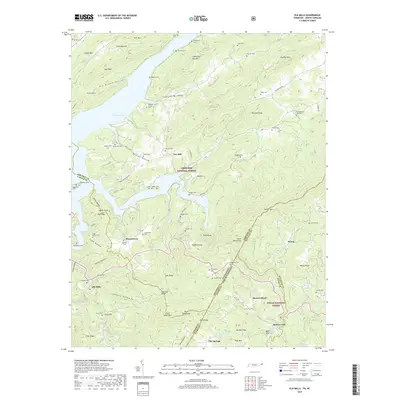
2019 Map of Elk Mills
USGS Topo · Published 2019About this map
Watauga Lake anchors the northwestern corner of this study, where the waters are contained by the surrounding peaks of the Cherokee National Forest and Pisgah National Forest. The landscape is defined by its deep hollows and high ridges, such as Dry Branch Hollow and Buck Ridge, which separate small mountain communities. Settlements like Elk Mills and Dry Hill are joined by an extensive network of family and community burial grounds, including Stansberry Cem, Payne Cem, and Combs Cem. The Tennessee-North Carolina state line cuts diagonally through the southeastern quadrant, dividing the area between Johnson, Carter, Watauga, and Avery counties. This complex boundary arrangement, combined with the presence of Midway Church and scattered mountain hamlets like Peoria and Flat Springs, illustrates a long-standing pattern of high-country settlement along the Elk River drainage.
Find a feature on this map
97 named features on this map. Tap any name to fly to it.
Don’t see what you’re looking for? This feature index may not catch every label — zoom into the map to look around manually.
Map Details
Editions of this 2019 Elk Mills Map
This is the sole edition of this map. No revisions or reprints were ever made.
Other maps of this area

1891 · Roan Mountain
USGS Topo · 1:125,000

1893 · Cranberry
USGS Topo · 1:125,000

1894 · Roan Mountain
USGS Topo · 1:125,000

1895 · Cranberry
USGS Topo · 1:125,000

1899 · Cranberry
USGS Topo · 1:125,000

1902 · Cranberry
USGS Topo · 1:125,000

1904 · Roan Mountain
USGS Topo · 1:125,000

1934 · Valle Crucis
USGS Topo · 1:24,000

1934 · White Rocks Mtn
USGS Topo · 1:24,000

1934 · Elk Park
USGS Topo · 1:24,000