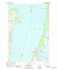
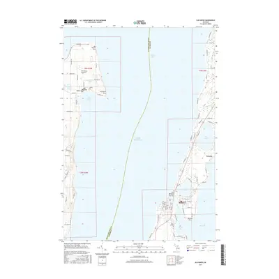
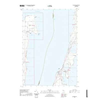
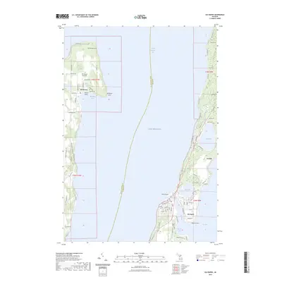
1983 Map of Elk Rapids
USGS Topo · Published 1984About this map
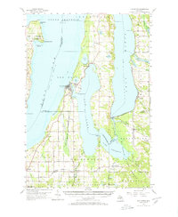
The waters of the East Arm of Grand Traverse Bay dominate this coastal survey, which highlights the peninsula-heavy geography of Northwest Michigan in the early 1980s. The village of Elk Rapids sits as a critical gateway between the bay and the interior lake systems, where the Elk River flows toward Elk Lake. To the west, the tip of the Old Mission Peninsula is defined by Old Mission Point, the historic settlement of Old Mission, and Old Mission Harbor. The map records the cultural landscape of the era, from the Lighthouse on the northern shore to local gathering places like Maple Grove Cem, Calvary Ch, and Cherryland Sch. Roads such as Smokey Hollow Road and Brinkman Road weave through the cherry-growing region, connecting small lakeside communities like Kewadin and documenting the residential expansion around Bass Lake and Birch Lake.
Find a feature on this map
49 named features on this map. Tap any name to fly to it.
Don’t see what you’re looking for? This feature index may not catch every label — zoom into the map to look around manually.
Map Details
Editions of this 1983 Elk Rapids Map
This is the sole edition of this map. No revisions or reprints were ever made.
Historical Maps of Peninsula Township Through Time
7 maps found
Featured Locations
- Elk Rapids Township, MI
- Milton Township, MI
- Torch Lake Township, MI
- Peninsula Township, MI
- Elk Rapids, Elk Rapids Township