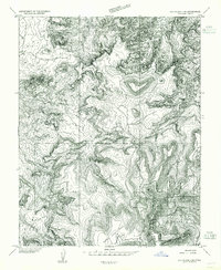
1954 Map of Elk Ridge 2 NE
USGS Topo · Published 1954About this map
Cliff Dwelling sites tucked within the canyon walls provide a glimpse into the ancient habitation of this high-desert landscape during the mid-1950s. The area, largely contained within the Manti-La Sal National Forest, is defined by deep incisions such as Calf Canyon and the winding course of Beef Wash. This preliminary survey highlights the dramatic verticality of Beef Basin and the expansive plateaus of Salt Creek Mesa and North Long Point. The presence of an isolated Reservoir and a singular Trail suggests a history of cattle ranching and seasonal movement through this remote part of San Juan County, Utah. The map documents the topography before more extensive modern infrastructure, preserving the natural drainage patterns and the primitive routes used by early twentieth-century explorers and ranchers.
Find a feature on this map
12 named features on this map. Tap any name to fly to it.
Don’t see what you’re looking for? This feature index may not catch every label — zoom into the map to look around manually.
Map Details
Editions of this 1954 Elk Ridge 2 NE Map
This is the sole edition of this map. No revisions or reprints were ever made.
Other maps of this area

1885 · La Sal
USGS Topo · 1:250,000

1886 · Abajo
USGS Topo · 1:250,000

1892 · Abajo
USGS Topo · 1:250,000

1893 · Abajo
USGS Topo · 1:250,000

1935 · Elk Ridge
USGS Topo · 1:96,000

1940 · Elk Ridge
USGS Topo · 1:125,000

1953 · The Needles
USGS Topo · 1:62,500

1954 · Elk Ridge 1 SW
USGS Topo · 1:24,000

1954 · Elk Ridge 2 SE
USGS Topo · 1:24,000

1954 · Elk Ridge 1 NW
USGS Topo · 1:24,000