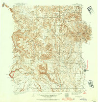
1935 Map of Elk Ridge
USGS Topo · Published 1954About this map
Blanding serves as the eastern anchor of this 1935 survey, which covers a high-altitude wilderness defined by the Abajo Mountains and the deep incisions of the Colorado River at Cataract Canyon. The landscape is a complex network of mesa tops and canyons, where archaeology and grazing overlap. Numerous Cliff Dwelling sites and Ruins are documented within Fable Valley and the Dark Canyon Plateau, alongside early 20th-century ranching outposts such as Wilson Ranch, Scorup Ranch, and Perkins Ranch.
Find a feature on this map
124 named features on this map. Tap any name to fly to it.
Don’t see what you’re looking for? This feature index may not catch every label — zoom into the map to look around manually.
Map Details
Editions of this 1935 Elk Ridge Map
2 editions found
Other maps of this area

1885 · San Rafael
USGS Topo · 1:250,000

1885 · La Sal
USGS Topo · 1:250,000

1886 · Henry Mountains
USGS Topo · 1:250,000

1886 · Abajo
USGS Topo · 1:250,000

1892 · Abajo
USGS Topo · 1:250,000

1892 · Henry Mountains
USGS Topo · 1:250,000

1893 · Abajo
USGS Topo · 1:250,000

1935 · Elk Ridge
USGS Topo · 1:96,000

1940 · Elk Ridge
USGS Topo · 1:125,000

1952 · Mouth of Dark Canyon
USGS Topo · 1:62,500