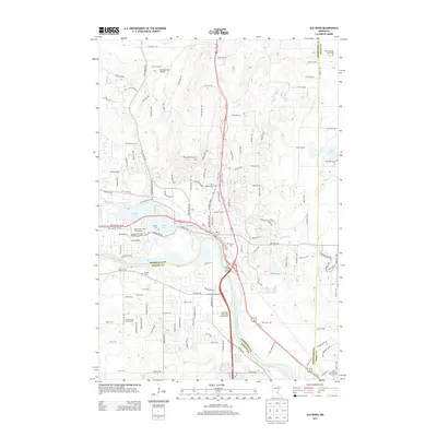
2013 Map of Elk River
USGS Topo · Published 2013About this map
The confluence of the Elk River and the Mississippi River serves as the focal point for this 2013 survey, where the river banks transition from developed town centers to recreational and agricultural corridors. This area is notable for its numerous small family and community burial sites, including the Farm of Ernest Rahn Cem, Saint Andrews Cem, and Orono Cem, providing vital clues for genealogical research. The landscape is a mix of suburban expansion and public space, evidenced by the Sherburne County Fair Grounds and the Mississippi Riverwoods Campground. Local infrastructure like the Meadowvale Airport and the Links at Northfork Golf Course sit among a dense network of residential roads such as Elk Lake Rd NW and 221st Ave NW. This document provides a look at the modern layout of these riverfront communities before more recent development further altered the terrain.
Find a feature on this map
127 named features on this map. Tap any name to fly to it.
Don’t see what you’re looking for? This feature index may not catch every label — zoom into the map to look around manually.
Map Details
Editions of this 2013 Elk River Map
This is the sole edition of this map. No revisions or reprints were ever made.
Other maps of this area

1902 · Anoka
USGS Topo · 1:62,500

1909 · Rockford
USGS Topo · 1:62,500

1916 · St. Francis
USGS Topo · 1:62,500

1919 · St. Francis
USGS Topo · 1:62,500

1953 · Stillwater
USGS Topo · 1:250,000

1955 · Anoka
USGS Topo · 1:24,000

1955 · Anoka
USGS Topo · 1:62,500

1955 · Stillwater
USGS Topo · 1:250,000

1958 · Stillwater
USGS Topo · 1:250,000

1958 · Rockford
USGS Topo · 1:62,500