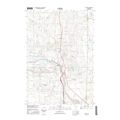
2016 Map of Elk River
USGS Topo · Published 2016About this map
The confluence of the Mississippi River and the Elk River defines the landscape of this 2016 survey, where the expanding residential grids of Elk River and Otsego meet the natural waterways of central Minnesota. The map provides a detailed view of local burial grounds and family landmarks, including the Farm of Ernest Rahn Cem, Saint Andrews Cem, and Norris Cem. These sites, alongside the Ostego Cem and Vernon Cem, offer significant reference points for genealogists tracking early families in the region.
Find a feature on this map
104 named features on this map. Tap any name to fly to it.
Don’t see what you’re looking for? This feature index may not catch every label — zoom into the map to look around manually.
Map Details
Editions of this 2016 Elk River Map
This is the sole edition of this map. No revisions or reprints were ever made.
Other maps of this area

1902 · Anoka
USGS Topo · 1:62,500

1909 · Rockford
USGS Topo · 1:62,500

1916 · St. Francis
USGS Topo · 1:62,500

1919 · St. Francis
USGS Topo · 1:62,500

1953 · Stillwater
USGS Topo · 1:250,000

1955 · Anoka
USGS Topo · 1:24,000

1955 · Anoka
USGS Topo · 1:62,500

1955 · Stillwater
USGS Topo · 1:250,000

1958 · Stillwater
USGS Topo · 1:250,000

1958 · Rockford
USGS Topo · 1:62,500