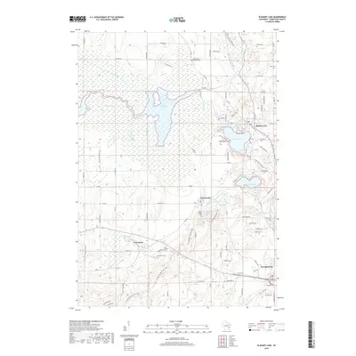
2018 Map of Elkhart Lake
USGS Topo · Published 2018About this map
Sheboygan Lake and its intricate drainage network, including the North Ditch and Began Ditch, define the western wetlands of this Sheboygan County landscape. In the east, the deep glacial waters of Elkhart Lake and Crystal Lake serve as focal points for the settlements of Elkhart Lake and Glenbeulah. The map provides a detailed record of the local cemetery network for genealogists, featuring sites like Saint Paul's Christian Cem and Saint Fridolin Cem. The winding course of the Mullet River cuts through the southern portion of the quadrangle, passing near Greenbush before heading toward the outskirts of Plymouth. Significant topographical features like Hickory Hill and Esker Ridge illustrate the area's distinct glacial heritage, while a dense network of county roads like Co Rd A and Co Rd J connect these historic villages.
Find a feature on this map
95 named features on this map. Tap any name to fly to it.
Don’t see what you’re looking for? This feature index may not catch every label — zoom into the map to look around manually.
Map Details
Editions of this 2018 Elkhart Lake Map
This is the sole edition of this map. No revisions or reprints were ever made.
Other maps of this area

1954 · Sheboygan Falls
USGS Topo · 1:62,500

1954 · School Hill
USGS Topo · 1:24,000

1954 · Howards Grove
USGS Topo · 1:62,500

1954 · Franklin
USGS Topo · 1:24,000

1954 · Kiel
USGS Topo · 1:62,500

1954 · Milwaukee
USGS Topo · 1:250,000

1955 · Kewaskum
USGS Topo · 1:62,500

1957 · Madison
USGS Topo · 1:250,000

1958 · Milwaukee
USGS Topo · 1:250,000

1960 · Madison
USGS Topo · 1:250,000