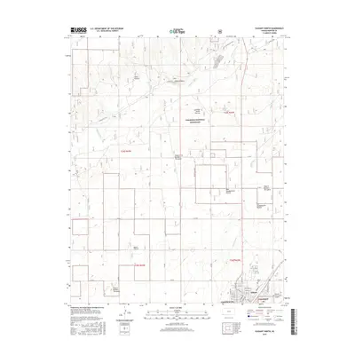
2015 Map of Elkhart North
USGS Topo · Published 2015About this map
The Cimarron National Grassland dominates this corner of Morton County, where the high plains transition into the managed grazing units of the Cimarron River valley. This 2015 survey reveals a landscape structured by the heritage of range management, clearly delineating named units such as West Headquarters Pasture, Pasture Number Thirtyfour, and Point Pasture. The historic Point of Rocks stands as a prominent landmark near the river, long serving as a navigational beacon for travelers on the Santa Fe Trail. Just south of the grassland, the town of Elkhart serves as the regional hub, its residential grid including streets like Colorado St and Jayhawk Blvd. The map also captures essential local infrastructure like the Elkhart-Morton County Airport and the Elkhart Cem, documenting the modern footprint of this agricultural community alongside historic routes like the Companion Trail.
Find a feature on this map
41 named features on this map. Tap any name to fly to it.
Don’t see what you’re looking for? This feature index may not catch every label — zoom into the map to look around manually.
Map Details
Editions of this 2015 Elkhart North Map
This is the sole edition of this map. No revisions or reprints were ever made.
Other maps of this area

1892 · Vilas
USGS Topo · 1:125,000

1954 · Perryton
USGS Topo · 1:250,000

1954 · Dalhart
USGS Topo · 1:250,000

1955 · La Junta
USGS Topo · 1:250,000

1955 · Dodge City
USGS Topo · 1:250,000

1958 · Perryton
USGS Topo · 1:250,000

1958 · La Junta
USGS Topo · 1:250,000

1958 · Dodge City
USGS Topo · 1:250,000

1958 · Dalhart
USGS Topo · 1:250,000

1959 · Dodge City
USGS Topo · 1:250,000