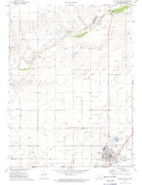
1973 Map of Elkhart North
USGS Topo · Published 1975About this map
Elkhart serves as the focal point of this 1970s survey, situated along the Kansas-Oklahoma border where the A T & S F railroad cuts across the High Plains. The landscape is defined by the wide, sandy course of the Cimarron River, which is flanked by the distinctive Point of Rocks and the Cimarron River Campground. This era reflects a transition in the local economy, with numerous gas wells and a Pipeline network crisscrossing the terrain alongside traditional ranching and civic features like the Fairground and Golf Course.
Find a feature on this map
28 named features on this map. Tap any name to fly to it.
Don’t see what you’re looking for? This feature index may not catch every label — zoom into the map to look around manually.
Map Details
Editions of this 1973 Elkhart North Map
This is the sole edition of this map. No revisions or reprints were ever made.
Other maps of this area

1892 · Vilas
USGS Topo · 1:125,000

1954 · Perryton
USGS Topo · 1:250,000

1954 · Dalhart
USGS Topo · 1:250,000

1955 · La Junta
USGS Topo · 1:250,000

1955 · Dodge City
USGS Topo · 1:250,000

1958 · Perryton
USGS Topo · 1:250,000

1958 · La Junta
USGS Topo · 1:250,000

1958 · Dodge City
USGS Topo · 1:250,000

1958 · Dalhart
USGS Topo · 1:250,000

1959 · Dodge City
USGS Topo · 1:250,000