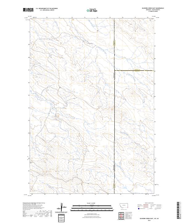
2024 Map of Elkhorn Creek East
USGS Topo · Published 2024About this map
The high plains of the Montana South Dakota borderlands are defined by a complex drainage network in this topographic study. The landscape is carved by seasonal waterways that feed into larger systems, most notably Elkhorn Creek which traverses the southern half of the quadrangle. This area serves as a significant jurisdictional meeting point, where Carter Co, Montana, intersects with Harding Co and Butte Co, South Dakota.
Find a feature on this map
18 named features on this map. Tap any name to fly to it.
Don’t see what you’re looking for? This feature index may not catch every label — zoom into the map to look around manually.
Map Details
Editions of this 2024 Elkhorn Creek East Map
This is the sole edition of this map. No revisions or reprints were ever made.
Other maps of this area

1935 · Harding
USGS Topo · 1:125,000

1954 · Lemmon
USGS Topo · 1:250,000

1954 · Ekalaka
USGS Topo · 1:250,000

1956 · Ekalaka
USGS Topo · 1:250,000

1957 · Lemmon
USGS Topo · 1:250,000

1958 · Ekalaka
USGS Topo · 1:250,000

1965 · Ekalaka
USGS Topo · 1:250,000
1977 · Greasewood Draw
USGS Topo · 1:24,000
1978 · Indian Butte
USGS Topo · 1:24,000
1978 · Gustave
USGS Topo · 1:24,000