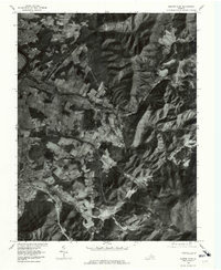
1977 Map of Elkton East
USGS Topo · Published 1981About this map
The South Fork Shenandoah River winds through the western edge of this 1970s orthophotoquad, defining a landscape where valley agriculture meets the steep slopes of the Blue Ridge. This photographic record, produced by the Geological Survey in cooperation with the Soil Conservation Service, documents the transition from the river lowlands to the high ridges followed by Skyline Drive. Settlements like Elkton and Shenandoah anchor the transport corridors, while smaller hamlets such as Furnace and Jollett sit at the base of the mountain hollows. The intricate network of drainage, including Naked Creek, Dry Run, and Elk Run, illustrates how the terrain dictated the placement of early homesteads and road networks in Rockingham County. The imagery provides a clear view of land-use patterns, showing the patchwork of fields along Hawksbill Cr and Comertown before late-century development.
Find a feature on this map
15 named features on this map. Tap any name to fly to it.
Don’t see what you’re looking for? This feature index may not catch every label — zoom into the map to look around manually.
Map Details
Editions of this 1977 Elkton East Map
This is the sole edition of this map. No revisions or reprints were ever made.
Other maps of this area

1892 · Woodstock
USGS Topo · 1:125,000

1892 · Gordonsville
USGS Topo · 1:125,000

1892 · Harrisonburg
USGS Topo · 1:125,000

1893 · Luray
USGS Topo · 1:125,000

1905 · Luray
USGS Topo · 1:125,000

1929 · Stony Man
USGS Topo · 1:48,000

1930 · Madison
USGS Topo · 1:48,000

1933 · Stony Man
USGS Topo · 1:62,500

1933 · Madison
USGS Topo · 1:62,500

1937 · Elkton
USGS Topo · 1:62,500