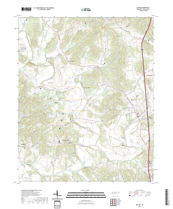
2022 Map of Elkton
USGS Topo · Published 2022About this map
Richland Creek and the Elk River converge in this southern Giles County landscape, defining a region where water power once fueled local industry at Vinta Mill and Morrell Mill. The terrain is marked by significant river features such as Beasley Island and Whitfield Island, while the high ground of Turkey Knob and Ward Bluff offers a contrast to the fertile bottomlands. Small rural settlements like Conway and Liberty are connected by the historical corridor of Elkton Pike, reflecting a long-established network of transport between Tennessee and Alabama.
Find a feature on this map
122 named features on this map. Tap any name to fly to it.
Don’t see what you’re looking for? This feature index may not catch every label — zoom into the map to look around manually.
Map Details
Editions of this 2022 Elkton Map
This is the sole edition of this map. No revisions or reprints were ever made.
Historical Maps of Poplar Hill Through Time
4 maps found