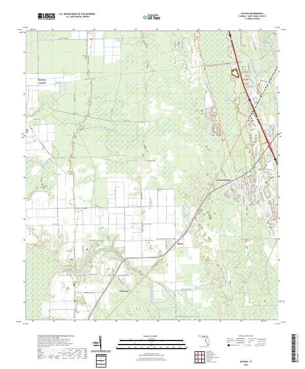
2024 Map of Elkton
USGS Topo · Published 2024About this map
The low-lying agricultural and wetland interior of St. Johns County defines this area, where the Palatka-to-St. Augustine State Trl follows a historical transportation corridor through the settlements of Elkton and Armstrong. These communities, along with the descriptively named Molasses Junction, reflect the rural development patterns of the Florida panhandle's eastern reaches. Much of the eastern landscape is shaped by drainage and water management, evidenced by the extensive Trestle Bay Swamp and the network of waterways including Moccasin Branch and McCullough Creek. The map shows a transition from structured agricultural plots, such as those near Poa Boy Farms RD, to more dense residential pockets like Vermont Heights. This modern survey documents the persistent rural character of the region while highlighting the repurposing of old rail routes into modern recreational corridors.
Find a feature on this map
73 named features on this map. Tap any name to fly to it.
Don’t see what you’re looking for? This feature index may not catch every label — zoom into the map to look around manually.
Map Details
Editions of this 2024 Elkton Map
This is the sole edition of this map. No revisions or reprints were ever made.
Other maps of this area

1912 · Palatka
USGS Topo · 1:48,000

1915 · Palatka
USGS Topo · 1:62,500

1937 · Bakersville
USGS Topo · 1:24,000

1937 · Elkton
USGS Topo · 1:24,000

1937 · Crescent Beach
USGS Topo · 1:24,000

1937 · Dinner Island
USGS Topo · 1:48,000

1937 · St. Augustine
USGS Topo · 1:24,000

1943 · St. Augustine
USGS Topo · 1:62,500

1943 · Dinner Island
USGS Topo · 1:62,500

1944 · Dinner Island
USGS Topo · 1:62,500