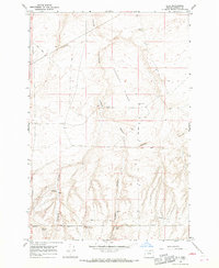
1968 Map of Ella
USGS Topo · Published 1970About this map
Ella stands at a remote crossroads in Morrow County, where the historic path of the Oregon Trail and the Immigrant Road converge among the drainage systems of Sixmile Canyon and Fourmile Canyon. This late-1960s landscape is defined by its arid cattle-ranching and agricultural infrastructure, evidenced by numerous water sources such as Boeing Well, Poverty Ridge Well, and a Flowing Well. The terrain is characterized by shifting Sand Dunes and the prominent rise of Poverty Ridge and Squaw Butte. Remote industrial and agricultural markers, including Storage Bins, a Tower, and a Water Tank, underscore the land's utility. Significant lengths of the Jeep Trail network provide access through the canyons, following a geography that has been used for transit since the earliest days of westward migration.
Find a feature on this map
18 named features on this map. Tap any name to fly to it.
Don’t see what you’re looking for? This feature index may not catch every label — zoom into the map to look around manually.
Map Details
Editions of this 1968 Ella Map
2 editions found
Other maps of this area

1906 · Blalock Island
USGS Topo · 1:125,000

1908 · Blalock Island
USGS Topo · 1:125,000

1953 · Pendleton
USGS Topo · 1:250,000

1956 · Pendleton
USGS Topo · 1:250,000

1962 · Alderdale
USGS Topo · 1:24,000

1962 · Boardman
USGS Topo · 1:24,000

1962 · Crow Butte
USGS Topo · 1:24,000

1968 · Ione North
USGS Topo · 1:24,000
1968 · Dalreed Butte
USGS Topo · 1:24,000
1968 · Cecil
USGS Topo · 1:24,000