
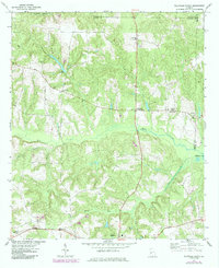
1971 Map of Ellaville North
USGS Topo · Published 1974About this map
Buck Creek and its many tributaries, including Coon Creek and Beaver Run, define the rolling landscape of northern Schley County. The agricultural character of the early 1970s is evident in the scattered rural settlements like Concord, Murrays Crossroads, and Sellars Store, which served as local hubs between larger towns. The southern edge of the map features the northern reaches of Ellaville, where the Central of Georgia railroad cuts through the terrain near Walls Crossing. Numerous rural congregations, such as Philippi Ch, Zion Hill Ch, and Hopewell Ch, are documented alongside their associated cemeteries, providing essential touchpoints for genealogical research. The presence of Hills Millpond on Coon Creek points to the area's long-standing reliance on local water resources for industry and agriculture.
Find a feature on this map
23 named features on this map. Tap any name to fly to it.
Don’t see what you’re looking for? This feature index may not catch every label — zoom into the map to look around manually.
Map Details
Editions of this 1971 Ellaville North Map
2 editions found
Other maps of this area

1955 · Phenix City
USGS Topo · 1:250,000

1957 · Phenix City
USGS Topo · 1:250,000

1958 · Phenix City
USGS Topo · 1:250,000

1971 · Rupert
USGS Topo · 1:24,000

1971 · Ideal South
USGS Topo · 1:24,000

1971 · Ideal North
USGS Topo · 1:24,000

1971 · Tazewell South
USGS Topo · 1:24,000
1971 · Tazewell North
USGS Topo · 1:24,000

1972 · Ellaville South
USGS Topo · 1:24,000
1972 · Andersonville
USGS Topo · 1:24,000