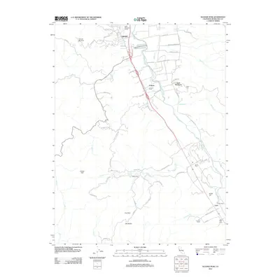
2012 Map of Elledge Peak
USGS Topo · Published 2012About this map
The Russian River corridor south of Ukiah dominates this 2012 survey, revealing a landscape defined by traditional ranching and Indigenous heritage. East of the river, the Ukiah Rancheria and the Indian Cem reflect the area's deep cultural roots, while the surrounding hills are dotted with family-named operations such as McNab Ranch, Henry Ranch, and the W L Crawford Ranch. This agricultural character is punctuated by the modern infrastructure of the Ukiah Municipal Airport and the community of El Roble.
Find a feature on this map
60 named features on this map. Tap any name to fly to it.
Don’t see what you’re looking for? This feature index may not catch every label — zoom into the map to look around manually.
Map Details
Editions of this 2012 Elledge Peak Map
This is the sole edition of this map. No revisions or reprints were ever made.
Other maps of this area

1920 · Ukiah
USGS Topo · 1:62,500

1938 · Hopland
USGS Topo · 1:62,500

1943 · Boonville
USGS Topo · 1:62,500

1943 · Hopland
USGS Topo · 1:62,500

1943 · Ornbaun
USGS Topo · 1:62,500

1944 · Ukiah
USGS Topo · 1:62,500

1944 · Ornbaun
USGS Topo · 1:62,500

1944 · Hopland
USGS Topo · 1:62,500

1947 · Santa Rosa
USGS Topo · 1:250,000

1949 · Santa Rosa
USGS Topo · 1:250,000