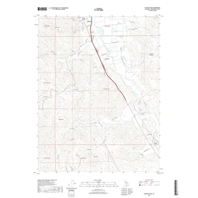
2018 Map of Elledge Peak
USGS Topo · Published 2018About this map
The Russian River corridor south of Ukiah serves as the primary artery of this Mendocino County landscape, where the valley floor transitions into the steep elevations of the Mayacmas Mountains and Elledge Peak. The settlement pattern follows the river and transportation lines, with the historic community of El Roble situated at the foot of Burke Hill Rd and Largo marking the southern reach near the confluence of Crawford Cr. This 2018 survey detail shows how modern infrastructure, including the Ukiah Municipal Airport, integrates with older land divisions and agricultural routes like McNab Ranch Rd and Butler Ranch Rd. Smaller watercourses such as McNab Cr, Feliz Cr, and Robinson Cr drain the high country, cutting through the terrain where landmarks like Goat Rock and Cleland Mtn dominate the horizon. The map provides a clear view of the complex road network connecting various ranches and hillsides to the central valley floor.
Find a feature on this map
97 named features on this map. Tap any name to fly to it.
Don’t see what you’re looking for? This feature index may not catch every label — zoom into the map to look around manually.
Map Details
Editions of this 2018 Elledge Peak Map
This is the sole edition of this map. No revisions or reprints were ever made.
Other maps of this area

1920 · Ukiah
USGS Topo · 1:62,500

1938 · Hopland
USGS Topo · 1:62,500

1943 · Boonville
USGS Topo · 1:62,500

1943 · Hopland
USGS Topo · 1:62,500

1943 · Ornbaun
USGS Topo · 1:62,500

1944 · Ukiah
USGS Topo · 1:62,500

1944 · Ornbaun
USGS Topo · 1:62,500

1944 · Hopland
USGS Topo · 1:62,500

1947 · Santa Rosa
USGS Topo · 1:250,000

1949 · Santa Rosa
USGS Topo · 1:250,000