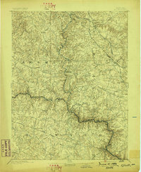
1894 Map of Ellicott
USGS Topo · Published 1898About this map
The Patapsco River carves a deep, winding valley through the center of this landscape, serving as a natural boundary between Carroll, Baltimore, and Howard counties. Surveyed in 1890, this area is defined by its transition from industrial river corridors to the developing hill country northwest of Baltimore. The Baltimore and Ohio Railroad follows the river's bend at Sykesville and Gaither, while the Western Maryland Railroad and Maryland Central R. R. service northern hubs like Glyndon and Emory Grove. Local industry is prominent near the water, with Check Mills and several granite Quarries dotting the hillsides near Granite. Notable landmarks include St. Charles College and a dense network of turnpikes like the Reisterstown Turnpike, which linked rural settlements to the growing port city nearby.
Find a feature on this map
80 named features on this map. Tap any name to fly to it.
Don’t see what you’re looking for? This feature index may not catch every label — zoom into the map to look around manually.
Map Details
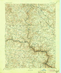
Editions of this 1894 Ellicott Map
3 editions found
Other maps of this area

1892 · Laurel
USGS Topo · 1:62,500

1892 · Ellicott
USGS Topo · 1:62,500

1893 · Frederick
USGS Topo · 1:125,000

1894 · Ellicott
USGS Topo · 1:62,500

1894 · Laurel
USGS Topo · 1:62,500

1894 · Baltimore
USGS Topo · 1:62,500

1894 · Frederick
USGS Topo · 1:125,000

1894 · Relay
USGS Topo · 1:62,500

1897 · Laurel
USGS Topo · 1:62,500

1899 · Baltimore
USGS Topo · 1:62,500