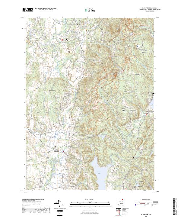
2024 Map of Ellington
USGS Topo · Published 2024About this map
Ellington and Somers anchor this contemporary topographic landscape, defined by a dense network of watercourses and cemeteries that reflect centuries of local heritage. The southern boundary of the map is dominated by the northern reaches of Shenipsit Lake, while Crystal Lake sits to the northeast, surrounded by residential development and the Crystal Lake Cem. These water bodies, along with smaller features like Charters Pond and Shady Lake, emphasize the region's historical reliance on its aquatic geography.
Find a feature on this map
63 named features on this map. Tap any name to fly to it.
Don’t see what you’re looking for? This feature index may not catch every label — zoom into the map to look around manually.
Map Details
Editions of this 2024 Ellington Map
This is the sole edition of this map. No revisions or reprints were ever made.
Other maps of this area

1886 · Springfield
USGS Topo · 1:62,500

1887 · Palmer
USGS Topo · 1:62,500

1889 · Springfield
USGS Topo · 1:62,500

1889 · Palmer
USGS Topo · 1:62,500

1892 · Hartford
USGS Topo · 1:62,500

1892 · Tolland
USGS Topo · 1:62,500

1893 · Springfield
USGS Topo · 1:62,500

1893 · Palmer
USGS Topo · 1:62,500

1895 · Springfield
USGS Topo · 1:62,500

1896 · Holyoke
USGS Topo · 1:125,000