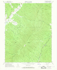
1967 Map of Elliott Knob
USGS Topo · Published 1968About this map
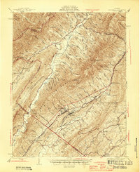
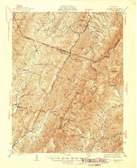
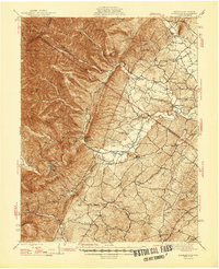
North Mountain dominates this mid-century topographic survey, where the high ridge of George Washington National Forest meets the developed corridors of the Deerfield Valley. The landscape is defined by its water sources and early industry, featuring the Calfpasture River and its numerous mountain drafts. Near Mt Elliott Springs, the presence of a claypit and kilns adjacent to the Chesapeake and Ohio railroad tracks points to the region's extraction history. Local landmarks like the Ray Memorial Ch, a small cemetery, and a Landing Strip near White Rock Branch provide specific points of interest for genealogists tracing family footprints. The summit of Elliott Knob is clearly marked with its Lookout Tower, serving as a primary navigational and fire-watch landmark overlooking the complex drainage systems of Still Run and Ramseys Draft.
Find a feature on this map
65 named features on this map. Tap any name to fly to it.
Don’t see what you’re looking for? This feature index may not catch every label — zoom into the map to look around manually.
Map Details
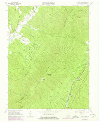
Editions of this 1967 Elliott Knob Map
2 editions found
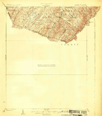
Other maps of this area

1894 · Staunton
USGS Topo · 1:125,000
1924 · Mc Dowell
USGS Topo · 1:62,500
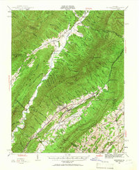
1943 · Craigsville
USGS Topo · 1:62,500
1944 · Parnassus
USGS Topo · 1:62,500
1944 · Mc Dowell
USGS Topo · 1:62,500
1944 · Staunton
USGS Topo · 1:62,500
1945 · Craigsville
USGS Topo · 1:62,500
1946 · Mc Dowell
USGS Topo · 1:62,500

1947 · Staunton
USGS Topo · 1:62,500
1947 · Parnassus
USGS Topo · 1:62,500