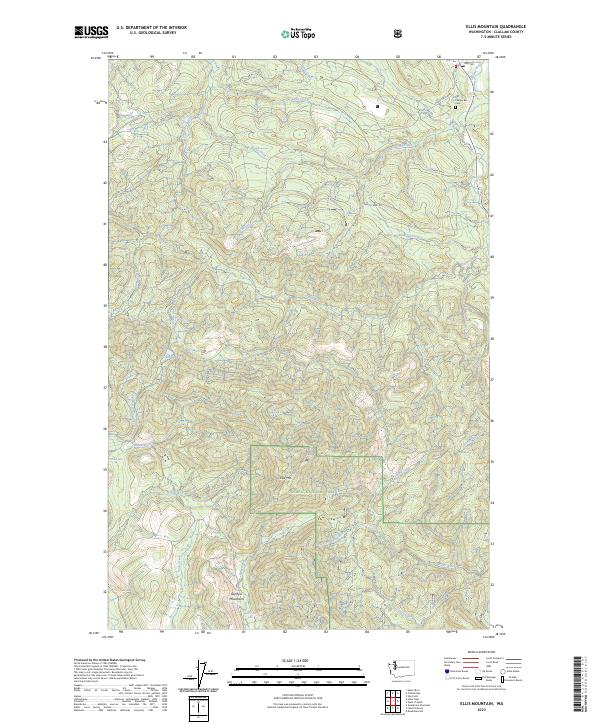
2023 Map of Ellis Mountain
USGS Topo · Published 2023About this map
Ellis Mtn and the surrounding high country of the Olympic National Forest dominate this Clallam County landscape, where deep drainages and ridges define the timbered interior. The hydrological network is the most prominent characteristic of the terrain, with the Pysht River and its tributary, the West Fork Pysht River, carving through the southern half of the quadrangle. To the north, the Clallam River and Little Hoko River drain toward the coast, joined by numerous named creeks like Charley Creek and Blowder Creek.
Find a feature on this map
39 named features on this map. Tap any name to fly to it.
Don’t see what you’re looking for? This feature index may not catch every label — zoom into the map to look around manually.
Map Details
Editions of this 2023 Ellis Mountain Map
This is the sole edition of this map. No revisions or reprints were ever made.
Other maps of this area

1922 · Pysht
USGS Topo · 1:62,500

1935 · Clallam
USGS Topo · 1:62,500

1935 · Lake Pleasant
USGS Topo · 1:62,500

1942 · Pysht
USGS Topo · 1:62,500

1942 · Clallam
USGS Topo · 1:62,500

1942 · Lake Pleasant
USGS Topo · 1:62,500

1953 · Cape Flattery
USGS Topo · 1:250,000

1957 · Lake Pleasant
USGS Topo · 1:62,500
1957 · Pysht
USGS Topo · 1:62,500
1957 · Clallam Bay
USGS Topo · 1:62,500