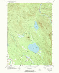
1968 Map of Ellis Pond
USGS Topo · Published 1972About this map
The Radio Facility (Telstar) stands as a technological landmark in this Oxford County landscape, marking the era of early satellite communications near the Andover town line. This 1968 field-checked survey details a region defined by its complex drainage systems and prominent peaks, where the Ellis River and the East Branch Swift River carve through the terrain. The presence of the Stockbridge Cem and West Byron Cem provides specific points of interest for genealogists tracing local families in the townships of Byron and Andover. Recreation and natural geography center on Ellis Pond and the smaller Little Ellis Pond, with French Island sitting prominently in the larger basin. From the steep slopes of Old Blue Mountain to the depths of Coos Canyon, the map recording the foot of the White Mountains depicts a transitional period between traditional land use and modern infrastructure.
Find a feature on this map
41 named features on this map. Tap any name to fly to it.
Don’t see what you’re looking for? This feature index may not catch every label — zoom into the map to look around manually.
Map Details
Editions of this 1968 Ellis Pond Map
2 editions found
Other maps of this area

1927 · Rumford
USGS Topo · 1:48,000

1930 · Rumford
USGS Topo · 1:62,500

1933 · Rangeley
USGS Topo · 1:48,000

1939 · Rangeley
USGS Topo · 1:62,500

1940 · Oquossoc
USGS Topo · 1:62,500

1942 · Oquossoc
USGS Topo · 1:62,500

1943 · Old Speck Mtn
USGS Topo · 1:62,500

1945 · Old Speck Mtn
USGS Topo · 1:62,500

1949 · Rangeley
USGS Topo · 1:62,500

1950 · Lewiston
USGS Topo · 1:250,000