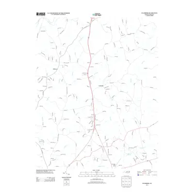
2013 Map of Ellisboro
USGS Topo · Published 2013About this map
Ellisboro and the surrounding Rockingham County landscape are defined by a network of creeks and small aviation outposts in this modern digital survey. The northern reaches are shaped by the Dan River, while the central terrain is drained by Hogans Cr and Brushy Cr. Rural settlements like Gold Hill and the curiously named Intelligence represent the local community hubs of this era. Smaller aviation fields, including Lindsay Airport and Greensboro North Airport, anchor the transportation network alongside established routes like Ellisboro Rd. In the southeastern corner, Troublesome Cr flows toward Price Mill Lake, illustrating the persistent role of water resources in the regional topography. The map detail reflects a transition from traditional farming tracts to named residential roads and loops such as Bald Hill Loop and Sally Loop, documenting the evolving land-use patterns of the early 21st century.
Find a feature on this map
179 named features on this map. Tap any name to fly to it.
Don’t see what you’re looking for? This feature index may not catch every label — zoom into the map to look around manually.
Map Details
Editions of this 2013 Ellisboro Map
This is the sole edition of this map. No revisions or reprints were ever made.
Other maps of this area

1951 · Lake Brandt
USGS Topo · 1:24,000

1953 · Winston-Salem
USGS Topo · 1:250,000

1953 · Greensboro
USGS Topo · 1:250,000

1954 · Greensboro
USGS Topo · 1:250,000

1955 · Winston-Salem
USGS Topo · 1:250,000

1962 · Winston-Salem
USGS Topo · 1:250,000

1962 · Greensboro
USGS Topo · 1:250,000

1966 · Greensboro
USGS Topo · 1:250,000

1969 · Summerfield
USGS Topo · 1:24,000

1969 · Belews Creek
USGS Topo · 1:24,000