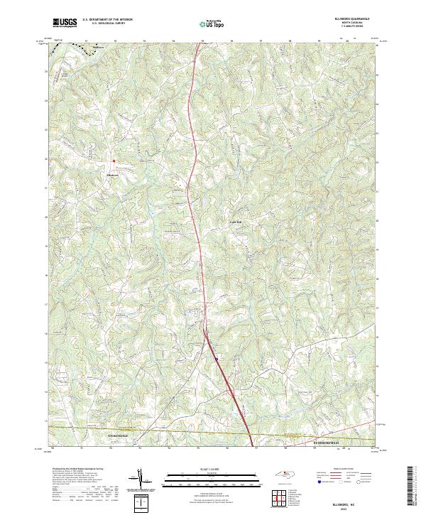
2022 Map of Ellisboro
USGS Topo · Published 2022About this map
Madison and the rural crossroads of Ellisboro anchor this landscape along the northern edge of the Piedmont, where the Dan River cuts through the northern reaches of the quadrangle. The terrain is defined by a dense network of winding creeks and family-named roads that reflect generations of local settlement. Numerous small waterways, including Hogans Cr, Brushy Cr, and Troublesome Cr, weave between ridges such as Bald Hill Loop.
Find a feature on this map
142 named features on this map. Tap any name to fly to it.
Don’t see what you’re looking for? This feature index may not catch every label — zoom into the map to look around manually.
Map Details
Editions of this 2022 Ellisboro Map
This is the sole edition of this map. No revisions or reprints were ever made.
Other maps of this area

1951 · Lake Brandt
USGS Topo · 1:24,000

1953 · Winston-Salem
USGS Topo · 1:250,000

1953 · Greensboro
USGS Topo · 1:250,000

1954 · Greensboro
USGS Topo · 1:250,000

1955 · Winston-Salem
USGS Topo · 1:250,000

1962 · Winston-Salem
USGS Topo · 1:250,000

1962 · Greensboro
USGS Topo · 1:250,000

1966 · Greensboro
USGS Topo · 1:250,000

1969 · Summerfield
USGS Topo · 1:24,000

1969 · Belews Creek
USGS Topo · 1:24,000