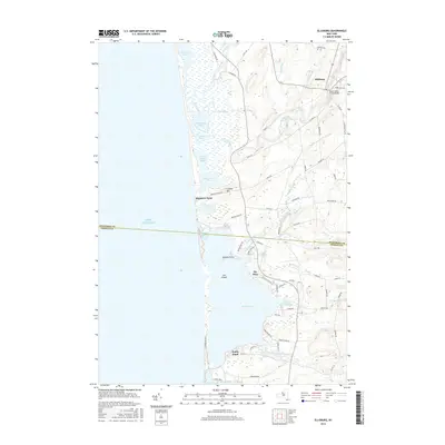
2016 Map of Ellisburg
USGS Topo · Published 2016About this map
Lake Ontario defines the western edge of this coastal landscape, where a complex network of barrier ponds and wetlands separates the great lake from the interior. The settlement of Ellisburg sits inland along South Sandy Creek, marked by the South Sandy Creek Bridge and surrounded by a dense grid of rural roads like Machold RD and Torrey Hill RD. The shoreline is characterized by distinct points and coves, including Montario Point and Greene Point, which frame Renshaw Bay. Moving south, the terrain transitions into a series of large water bodies such as North Pond, South Pond, and Sandy Pond. This 2016 survey captures the contemporary layout of lakeside communities like The Elms, showing the development of coastal access roads and the preservation of large marshy tracts like Lakeview Pond and Floodwood Pond along the Jefferson and Oswego county line.
Find a feature on this map
79 named features on this map. Tap any name to fly to it.
Don’t see what you’re looking for? This feature index may not catch every label — zoom into the map to look around manually.
Map Details
Editions of this 2016 Ellisburg Map
This is the sole edition of this map. No revisions or reprints were ever made.
Other maps of this area

1893 · Sackets Harbor
USGS Topo · 1:62,500

1895 · Sacketts Harbor
USGS Topo · 1:62,500

1895 · Stony Island
USGS Topo · 1:62,500

1895 · Pulaski
USGS Topo · 1:62,500

1942 · Stony Point
USGS Topo · 1:31,680

1942 · Sandy Creek
USGS Topo · 1:24,000

1943 · Henderson
USGS Topo · 1:31,680

1943 · Pulaski
USGS Topo · 1:31,680

1943 · Richland
USGS Topo · 1:31,680

1943 · Texas
USGS Topo · 1:31,680