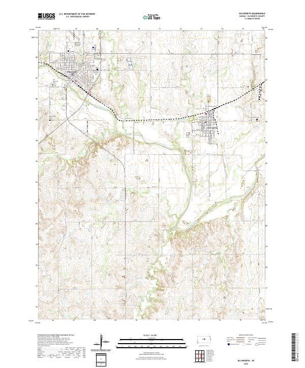
2022 Map of Ellsworth
USGS Topo · Published 2022About this map
Ellsworth serves as the central hub of this Central Kansas landscape, where the Ellsworth County Courthouse stands near the bend of the Smoky Hill River. The map details a transition from the structured street grid of the county seat to the neighboring town of Kanopolis to the east. This area is a significant point of interest for genealogists, as it includes multiple burial sites such as the Old Ellsworth Cem, Ellsworth Memorial Cem, and the Bickerdyke Cem located west of the main settlement.
Find a feature on this map
42 named features on this map. Tap any name to fly to it.
Don’t see what you’re looking for? This feature index may not catch every label — zoom into the map to look around manually.
Map Details
Editions of this 2022 Ellsworth Map
This is the sole edition of this map. No revisions or reprints were ever made.
Other maps of this area

1894 · Ellsworth
USGS Topo · 1:125,000

1955 · Great Bend
USGS Topo · 1:250,000

1957 · Great Bend
USGS Topo · 1:250,000

1957 · Ellsworth
USGS Topo · 1:24,000

1957 · Westfall SW
USGS Topo · 1:24,000

1957 · Westfall SE
USGS Topo · 1:24,000
1957 · Carneiro
USGS Topo · 1:24,000

1957 · Holyrood NE
USGS Topo · 1:24,000

1957 · Black Wolf
USGS Topo · 1:24,000

1958 · Great Bend
USGS Topo · 1:250,000