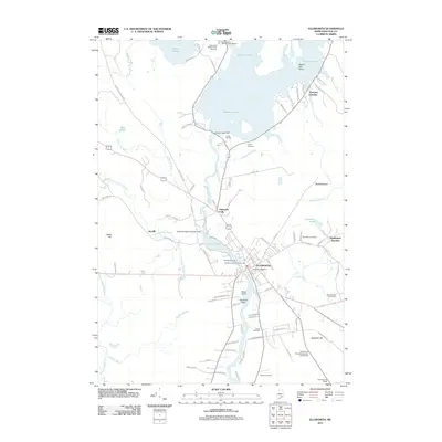
2011 Map of Ellsworth
USGS Topo · Published 2011About this map
Ellsworth and its industrial heart along the Union River define this coastal Maine landscape. The river's power is harnessed by several structures, including the Ellsworth Dam and the Ellsworth Water Company Dam further upstream at Leonard Lake. These water resources supported the local economy, while the Graham Lake Dam to the north controls the significant expanse of Graham Lake, which dominates the northern half of the quadrangle.
Find a feature on this map
100 named features on this map. Tap any name to fly to it.
Don’t see what you’re looking for? This feature index may not catch every label — zoom into the map to look around manually.
Map Details
Editions of this 2011 Ellsworth Map
This is the sole edition of this map. No revisions or reprints were ever made.
Other maps of this area

1900 · Orland
USGS Topo · 1:62,500

1904 · Mount Desert
USGS Topo · 1:62,500

1904 · Bluehill
USGS Topo · 1:62,500

1905 · Penobscot Bay
USGS Topo · 1:125,000

1911 · Ellsworth
USGS Topo · 1:62,500

1940 · Ellsworth
USGS Topo · 1:62,500

1942 · Orland
USGS Topo · 1:62,500

1942 · Ellsworth
USGS Topo · 1:62,500

1942 · Mount Desert
USGS Topo · 1:62,500

1944 · Blue Hill
USGS Topo · 1:62,500