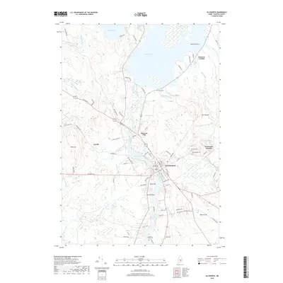
2018 Map of Ellsworth
USGS Topo · Published 2018About this map
The Union River serves as the central artery for this part of Hancock County, flowing south from the sprawling waters of Graham Lake through the community of Ellsworth Falls and into the heart of Ellsworth. The landscape is defined by its industrial and maritime history, where the river's descent creates natural power sites like those near Leonard Lake. Beyond the urban center, the map reveals a network of smaller settlements and junctions, including Washington Junction and the rural enclave of Joyville. For those exploring local family histories, several significant burial sites are documented, most notably the Old Burying Ground Cem near the town center and the Fullerton Milliken Cem further south. The terrain transitions from the lowlands of Cushmans Meadow to prominent elevations like Watts Hill and Beckwith Hill, illustrating the varied geography of the Maine coast's interior.
Find a feature on this map
93 named features on this map. Tap any name to fly to it.
Don’t see what you’re looking for? This feature index may not catch every label — zoom into the map to look around manually.
Map Details
Editions of this 2018 Ellsworth Map
This is the sole edition of this map. No revisions or reprints were ever made.
Other maps of this area

1900 · Orland
USGS Topo · 1:62,500

1904 · Mount Desert
USGS Topo · 1:62,500

1904 · Bluehill
USGS Topo · 1:62,500

1905 · Penobscot Bay
USGS Topo · 1:125,000

1911 · Ellsworth
USGS Topo · 1:62,500

1940 · Ellsworth
USGS Topo · 1:62,500

1942 · Orland
USGS Topo · 1:62,500

1942 · Ellsworth
USGS Topo · 1:62,500

1942 · Mount Desert
USGS Topo · 1:62,500

1944 · Blue Hill
USGS Topo · 1:62,500