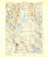
1911 Map of Ellsworth
USGS Topo · Published 1941About this map
The coastal and inland landscape of Hancock County reveals a complex network of waterways and early 20th-century transportation hubs. Washington Junction stands as a critical nexus for the Maine Central RR, illustrating the importance of rail transit in connecting the interior timber and granite regions to the coast. The terrain is defined by glacial features such as Beech Hill Pond and Green Lake, interspersed with distinctive heaths like Casebolt Heath and Georges Heath.
Find a feature on this map
128 named features on this map. Tap any name to fly to it.
Don’t see what you’re looking for? This feature index may not catch every label — zoom into the map to look around manually.
Map Details
Editions of this 1911 Ellsworth Map
5 editions found
Other maps of this area

1900 · Orland
USGS Topo · 1:62,500

1902 · Orono
USGS Topo · 1:62,500

1904 · Mount Desert
USGS Topo · 1:62,500

1904 · Bar Harbor
USGS Topo · 1:62,500

1904 · Bluehill
USGS Topo · 1:62,500

1905 · Penobscot Bay
USGS Topo · 1:125,000

1911 · Ellsworth
USGS Topo · 1:62,500

1929 · Great Pond
USGS Topo · 1:48,000

1929 · Lead Mountain
USGS Topo · 1:48,000

1930 · Tunk Lake
USGS Topo · 1:48,000