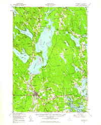
1957 Map of Ellsworth
USGS Topo · Published 1962About this map
Ellsworth serves as the hub of this mid-century landscape, where the Maine Central Railroad and several major highways converge. The city’s industrial and transportation roots are evident at Ellsworth Falls and Washington Junction, while the surrounding townships of Mariaville, Waltham, and Hancock retain a rural, water-defined character. The Union River system, including the West Branch Union River and East Branch Union River, dominates the central terrain, feeding into the expansive waters of Graham Lake.
Find a feature on this map
149 named features on this map. Tap any name to fly to it.
Don’t see what you’re looking for? This feature index may not catch every label — zoom into the map to look around manually.
Map Details
Editions of this 1957 Ellsworth Map
3 editions found
Other maps of this area

1900 · Orland
USGS Topo · 1:62,500

1902 · Orono
USGS Topo · 1:62,500

1904 · Mount Desert
USGS Topo · 1:62,500

1904 · Bar Harbor
USGS Topo · 1:62,500

1904 · Bluehill
USGS Topo · 1:62,500

1905 · Penobscot Bay
USGS Topo · 1:125,000

1911 · Ellsworth
USGS Topo · 1:62,500

1929 · Great Pond
USGS Topo · 1:48,000

1929 · Lead Mountain
USGS Topo · 1:48,000

1930 · Tunk Lake
USGS Topo · 1:48,000