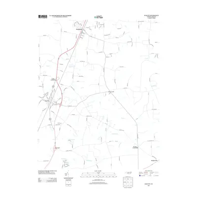
2013 Map of Elm City
USGS Topo · Published 2013About this map
Elm City and Sharpsburg anchor this 2013 landscape, where the traditional rail-and-road corridors of Wilson County intersect with an expansive network of wetlands and creeks. The core of Elm City is defined by its street grid, including W Main St and E Wilson St, while Sharpsburg occupies the northern edge of the quadrangle near E Railroad St, indicating the historical importance of the rail line to these small Piedmont communities.
Find a feature on this map
112 named features on this map. Tap any name to fly to it.
Don’t see what you’re looking for? This feature index may not catch every label — zoom into the map to look around manually.
Map Details
Editions of this 2013 Elm City Map
This is the sole edition of this map. No revisions or reprints were ever made.
Other maps of this area

1902 · Rocky Mount
USGS Topo · 1:62,500

1902 · Tarboro
USGS Topo · 1:62,500

1903 · Tarboro
USGS Topo · 1:62,500

1904 · Falkland
USGS Topo · 1:62,500

1904 · Rocky Mount
USGS Topo · 1:62,500

1904 · Wilson
USGS Topo · 1:62,500

1953 · Rocky Mount
USGS Topo · 1:250,000

1954 · Rocky Mount
USGS Topo · 1:250,000
1975 · Rocky Mount
USGS Topo · 1:24,000
1977 · Nashville
USGS Topo · 1:24,000