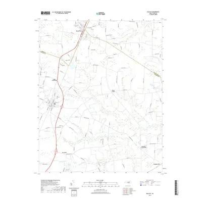
2019 Map of Elm City
USGS Topo · Published 2019About this map
Elm City and Sharpsburg anchor the western corridor of this 2019 survey, illustrating the persistence of rail-aligned settlements along the border of Nash and Wilson counties. The landscape is defined by its intricate hydrography, where the headwaters of Cattail Swamp and Town Creek carve through the agricultural coastal plain. This modern topographic study preserves the placement of long-established rural junctions such as Cobbs Crossroads and Penders Crossroads, which continue to serve as local landmarks amidst a patchwork of family farms and timber tracts.
Find a feature on this map
110 named features on this map. Tap any name to fly to it.
Don’t see what you’re looking for? This feature index may not catch every label — zoom into the map to look around manually.
Map Details
Editions of this 2019 Elm City Map
This is the sole edition of this map. No revisions or reprints were ever made.
Other maps of this area

1902 · Rocky Mount
USGS Topo · 1:62,500

1902 · Tarboro
USGS Topo · 1:62,500

1903 · Tarboro
USGS Topo · 1:62,500

1904 · Falkland
USGS Topo · 1:62,500

1904 · Rocky Mount
USGS Topo · 1:62,500

1904 · Wilson
USGS Topo · 1:62,500

1953 · Rocky Mount
USGS Topo · 1:250,000

1954 · Rocky Mount
USGS Topo · 1:250,000
1975 · Rocky Mount
USGS Topo · 1:24,000
1977 · Nashville
USGS Topo · 1:24,000