2022 Map of Elm City
USGS Topo · Published 2022About this map
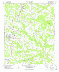
Elm City and Sharpsburg anchor this coastal plain landscape, situated along the CSX railroad corridor where three counties—Nash, Edgecombe, and Wilson—converge. The settlement pattern is defined by several rural junctions, including Cobbs Crossroads, Penders Crossroads, and Bridgersville, reflecting the region's agricultural roots and transition from rail-based town centers to highway-oriented crossroads. Local history is anchored by sites like Cedar Grove Cem, while the natural geography is dominated by a slow-moving drainage system of blackwater features. Streams such as Town Creek, Cattail Swamp, and White Swamp meander through the terrain, illustrating the intricate hydrology typical of the North Carolina inner coastal plain. The presence of Adams Pond and numerous small branches indicates a landscape historically shaped by both its transit networks and its water-rich environment.
Find a feature on this map
122 named features on this map. Tap any name to fly to it.
Don’t see what you’re looking for? This feature index may not catch every label — zoom into the map to look around manually.
Map Details
Editions of this 2022 Elm City Map
This is the sole edition of this map. No revisions or reprints were ever made.