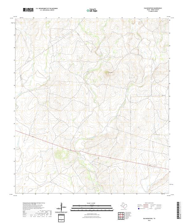
2022 Map of Elm Mountain
USGS Topo · Published 2022About this map
Elm Mtn rises as a prominent landmark in this segment of the West Texas brush country within Kinney County. The landscape is defined by the dendritic drainage patterns of Elm Cr, Lindsey Cr, and Arenosa Cr, which carve through the Edwards Plateau terrain. The map details a network of ranch access and rural routes, reflecting the region's long-standing pastoral economy. Notable local thoroughfares include U-Bar Ranch Rd, Garza Ln, and Fritter Ln, which branch off from RM 334. This 2022 survey provides contemporary data on land use and water resources in a sparsely populated section of the state, where geographic features like named creeks and summits serve as the primary markers for property and navigation.
Find a feature on this map
8 named features on this map. Tap any name to fly to it.
Don’t see what you’re looking for? This feature index may not catch every label — zoom into the map to look around manually.
Map Details
Editions of this 2022 Elm Mountain Map
This is the sole edition of this map. No revisions or reprints were ever made.
Other maps of this area

1896 · Brackett
USGS Topo · 1:125,000

1897 · Brackett
USGS Topo · 1:125,000

1938 · Turkey Mountain
USGS Topo · 1:48,000

1943 · Turkey Mountain
USGS Topo · 1:62,500

1944 · Spofford
USGS Topo · 1:62,500

1944 · Brackettville
USGS Topo · 1:62,500

1949 · Cline
USGS Topo · 1:62,500

1958 · Del Rio
USGS Topo · 1:250,000

1964 · Del Rio
USGS Topo · 1:250,000
1974 · Elm Mountain
USGS Topo · 1:24,000