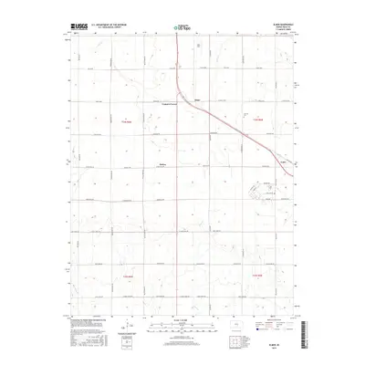
2015 Map of Elmer
USGS Topo · Published 2015About this map
Cruppers Corner and Darlow anchor this central Kansas landscape, where the agricultural grid of Reno County is bisected by the diagonal passage of Switzer Rd. The area is defined by a dense network of sectional roads such as Mills Ave and Trail W Rd, reflecting the systematic land division of the Great Plains. Waterways including Sand Cr and Red Rock Cr provide natural drainage across the otherwise orderly terrain. Further east, the settlement of Yoder and the Fairview Cem offer specific points of interest for genealogists tracing local families. The presence of specialized street names like Coral Sea Rd and Wasp Rd in the southeastern quadrant suggests more modern residential development or historical military influence tucked between the larger farming tracts.
Find a feature on this map
42 named features on this map. Tap any name to fly to it.
Don’t see what you’re looking for? This feature index may not catch every label — zoom into the map to look around manually.
Map Details
Editions of this 2015 Elmer Map
This is the sole edition of this map. No revisions or reprints were ever made.
Other maps of this area

1889 · Cheney
USGS Topo · 1:125,000

1891 · Hutchinson
USGS Topo · 1:125,000

1891 · Cheney
USGS Topo · 1:125,000

1892 · Kingman
USGS Topo · 1:125,000

1893 · Hutchinson
USGS Topo · 1:125,000

1894 · Kingman
USGS Topo · 1:125,000

1894 · Lyons
USGS Topo · 1:125,000

1901 · Cheney
USGS Topo · 1:125,000

1955 · Wichita
USGS Topo · 1:250,000

1955 · Great Bend
USGS Topo · 1:250,000