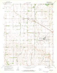
1961 Map of Elmer
USGS Topo · Published 1963About this map
The Hutchinson Air Force Station dominates the eastern landscape of Reno County, situated at a strategic junction south of the Arkansas River. This early 1960s survey documents a region defined by the convergence of major rail lines, with the Atchison Topeka and Santa Fe and the Missouri Pacific railroads intersecting near the small community of Elmer. Smaller rural crossroads such as Cruppers Corner and Darlow anchor the agricultural sections of Lincoln and Castleton townships. Local landmarks like Fairview Cem, Pleasant View Ch, and several Gas Wells illustrate the social and industrial patterns of the era. The terrain is marked by the winding courses of Sand Creek and Red Rock Creek, which carve through the plains toward the river.
Find a feature on this map
17 named features on this map. Tap any name to fly to it.
Don’t see what you’re looking for? This feature index may not catch every label — zoom into the map to look around manually.
Map Details
Editions of this 1961 Elmer Map
This is the sole edition of this map. No revisions or reprints were ever made.
Other maps of this area

1889 · Cheney
USGS Topo · 1:125,000

1891 · Hutchinson
USGS Topo · 1:125,000

1891 · Cheney
USGS Topo · 1:125,000

1892 · Kingman
USGS Topo · 1:125,000

1893 · Hutchinson
USGS Topo · 1:125,000

1894 · Kingman
USGS Topo · 1:125,000

1894 · Lyons
USGS Topo · 1:125,000

1901 · Cheney
USGS Topo · 1:125,000

1955 · Wichita
USGS Topo · 1:250,000

1955 · Great Bend
USGS Topo · 1:250,000