2023 Map of Elmo
USGS Topo · Published 2023About this map
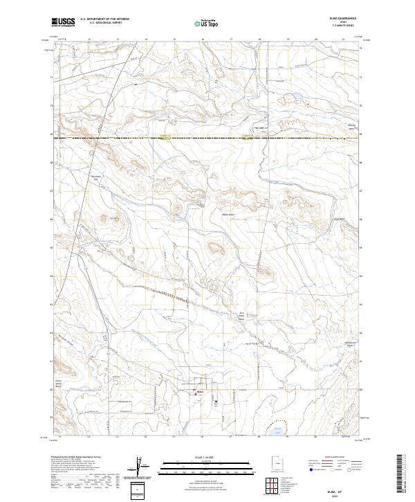
Elmo anchors this high-desert landscape near the Carbon and Emery County border, where an intricate network of irrigation systems supports local agricultural life. Significant water infrastructure, including the North Branch Cleveland Canal, the Elmo Branch Cleveland Canal, and the Carbon Canal, demonstrates the critical role of water management in this arid region. The town itself is centered around the Elmo Cem and is reached via arterial routes like Cleveland Road and East Main Street.
Find a feature on this map
48 named features on this map. Tap any name to fly to it.
Don’t see what you’re looking for? This feature index may not catch every label — zoom into the map to look around manually.
Map Details
Editions of this 2023 Elmo Map
This is the sole edition of this map. No revisions or reprints were ever made.