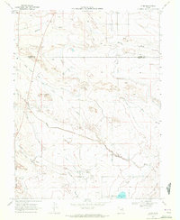
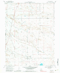
1969 Map of Elmo
USGS Topo · Published 1972About this map
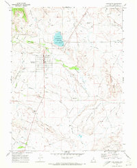
The small settlement of Elmo sits at the heart of this 1969 survey, where the agricultural life of the San Rafael Swell area is clearly mapped through its complex irrigation network. The landscape is defined by the Cleveland Canal and its various offshoots, including the North Branch Cleveland Canal and the Elmo Branch Cleveland Canal, which carry water through the desert terrain. To the south, the Desert Lake Waterfowl Management Area surrounds Desert Lake, providing a distinct ecological contrast to the dry draws and washes like Timothy Wash and Washboard Wash that cross the region. For those researching local history or genealogy, the map identifies a central Cem near the town site, while the surveyor's notes include various Borrow Pits and a Drill Hole, reflecting the utility and exploration of the land during this era.
Find a feature on this map
24 named features on this map. Tap any name to fly to it.
Don’t see what you’re looking for? This feature index may not catch every label — zoom into the map to look around manually.
Map Details
Editions of this 1969 Elmo Map
2 editions found
Other maps of this area

1886 · Price River
USGS Topo · 1:250,000

1896 · Price River
USGS Topo · 1:250,000

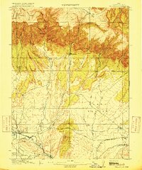
1914 · Castle Gate
USGS Topo · 1:62,500
1915 · Wellington
USGS Topo · 1:62,500

1916 · Castle Gate
USGS Topo · 1:62,500

1956 · Price
USGS Topo · 1:250,000

1960 · Price
USGS Topo · 1:250,000

1962 · Price
USGS Topo · 1:250,000
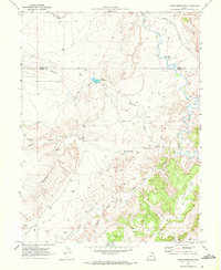
1969 · Olsen Reservoir
USGS Topo · 1:24,000
1969 · Huntington
USGS Topo · 1:24,000