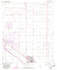
1965 Map of Eloy North
USGS Topo · Published 1983About this map
Agricultural development and early suburban expansion define the Santa Cruz Flats during this mid-century period. The town of Eloy and the community of Toltec anchor the map, showing a transition from open desert to organized street grids and municipal facilities like Jones Park and the Eloy Municipal Airport. This area's growth was heavily supported by the Southern Pacific railroad and a network of irrigation channels, including the Casa Grande Canal and its Extension, which enabled large-scale desert farming.
Find a feature on this map
33 named features on this map. Tap any name to fly to it.
Don’t see what you’re looking for? This feature index may not catch every label — zoom into the map to look around manually.
Map Details
Editions of this 1965 Eloy North Map
2 editions found
Other maps of this area

1922 · Red Rock No 2
USGS Topo · 1:48,000

1922 · Signal Peak
USGS Topo · 1:62,500

1924 · Signal Peak
USGS Topo · 1:62,500

1934 · Newman Peak
USGS Topo · 1:125,000

1947 · Red Rock
USGS Topo · 1:62,500

1947 · Eloy
USGS Topo · 1:62,500

1948 · Eloy
USGS Topo · 1:62,500

1956 · Tucson
USGS Topo · 1:250,000

1958 · Tucson
USGS Topo · 1:250,000

1959 · Tucson
USGS Topo · 1:250,000